Only a 45-minute drive from the hustle and bustle of Ecuador’s capital starts a completely different world. Once you cross the towering Andes mountains to the west, you enter the magical Chocó Andino, or Andean Chocó. The 286,000 ha nature reserve is where two Biodiversity Hotspots meet: the Tumbes-Chocó-Magdalena ecoregion, as well as the Tropical Andes.
The result? One of the most biodiverse areas in Ecuador.
In 2018, the Chocó Andino became Ecuador’s seventh UNESCO Biosphere Reserve. A Biosphere Reserve aims to conserve the biological and cultural diversity through socioeconomic development, while maintaining the harmony between nature and people.
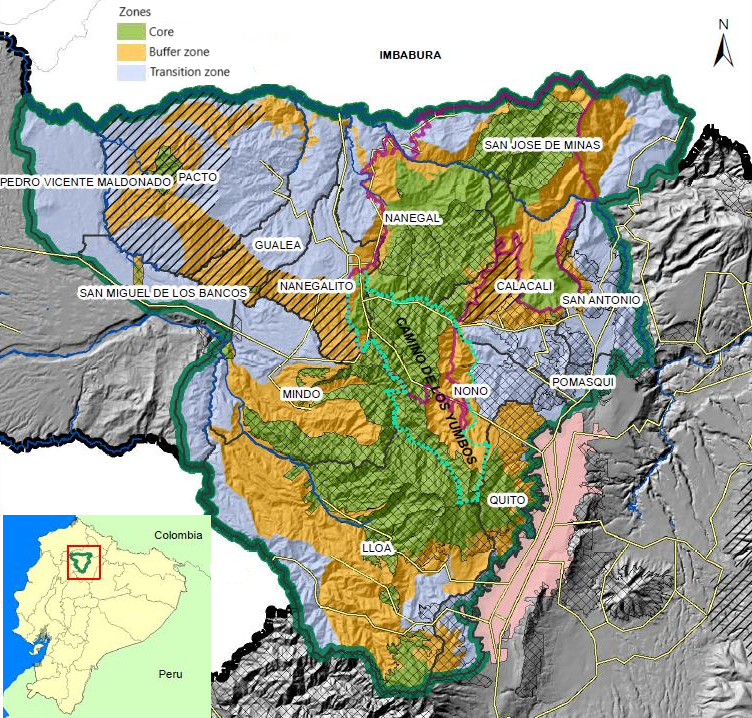
The reserve stretches from the low hills around the Mashpi river in the west, to the slopes of the Pichincha vulcano in the east. Many patches of intact Andean forests are still to be found here. The eastern part is well-protected with many existing reserves, both private and public. However, in the northwestern part of the Biosphere reserve, deforestation and fragmentation are threats. This is the part where we focus our efforts.
Because of its high diversity, the reserve contains at least nine public and private protected forests, three Conservation and Sustainable Use Areas (ACUS, in Spanish), an Andean Bear Corridor, four Important Bird Areas (IBAs, as identified by Birdlife International) and a Geobotanical Reserve.
The area owes its high biodiversity largely to the differences in elevation.
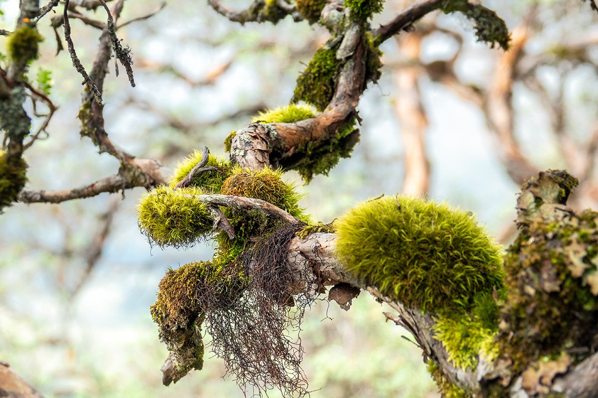
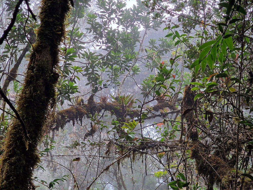
Montane cloud forests created many species that occur nowhere else
The landscape of the Biosphere Reserve is made up of a heterogeneous mosaic of different land uses. As of 2012, approximately 36% of the reserve was used for agriculture. Livestock pastures take up an additional 16% of the land. These areas generate a large amount of food that supplies mainly the consumption of urban Quito, such as milk and its derivatives, but also export food products are produced and processed as is the case of organic panela, coffee and chocolate. Around 55% of the reserve, i.e. 68,000 ha, is forested.
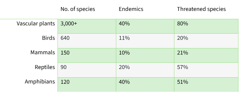
We already gave it away, but the Chocó Andino is immensely biodiverse. Highly specialized animals, large and small, find their niche along the >4000m altitude difference. For example, over 3,000 plants species have been registered in the area, of which 40% is found nowhere else. This amounts to one fifth of all vascular plants registered in Ecuador2 in just 0,7% of the national territory!
And probably there are even more plant species, as the area remains understudied.
However, so many species living on such a small land area can lead to challenges. Small disturbances can have a large impact. It is estimated that 80% of all plants are threatened. Other species are also threatened – though to a lesser extent.
The table below gives an overview of the number of species for plants and vertebrates, with a percentage of endemic and threatened species. Endemics are common for all species, but the percentage under threat is alarming.
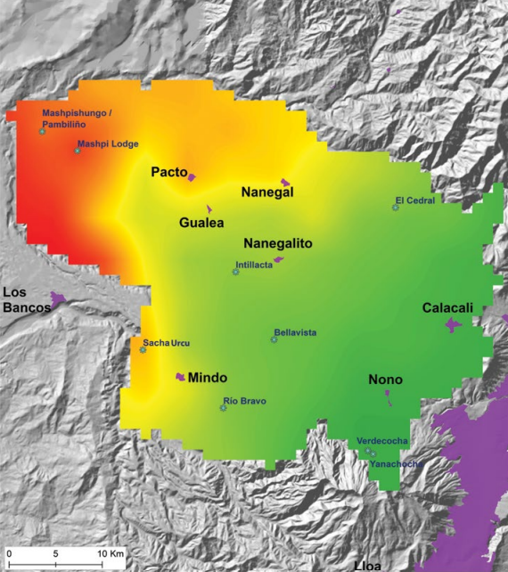
However, the number of species are not divided equally. The lower in altitude you get, the more plants and animals you will find. For the Chocó Andino Biosphere Reserve, that means the highest species density can be found in the western piemonte forests, around Mashpi. The cloud forest has an intermediate density, but this is where most of the endemics occur.1 The harsher climate at 2,500+ meters leads to relatively fewer species.
Currently, about 60% of the reserve remains forested. The highland páramo only adds 0.7% of the total surface area. The remaining 39% is taken up by human activities.
The main threats are smallholder agriculture and cattle ranching.
There is evidence of human presence in northwest Pichincha as far back as 5,000 BC. However, the most significant periods of agricultural expansion and deforestation occurred not too long ago. It started during the land reforms of the 1960s and 1970s and was further increased after construction of the main highway in the late 1990s, crossing the reserve from east to west. This loss of forest leads to fragmentation, as it breaks the connection between ecosystems in the area.
Let’s have a look at the deforestation map below. The reserve is relatively well-protected in the center and west. As a result, we find little deforestation here. In the west, however, the picture is different. Around Pacto and Guelea, a total of 6.556 ha was lost between 1991 and 2017. That’s about 15 percent of the total forest cover there.3
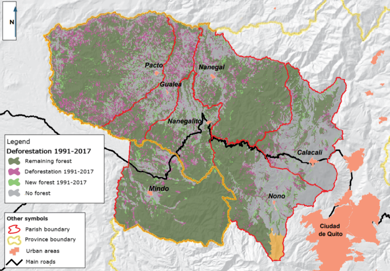
There is a clear link between the amount of remaining forest and the average steepness of the land, as well as between remaining forest and the distance from the nearest town. This suggests that forests are mostly left in hard-to-reach areas with steep slopes. This creates a big challenge for conserving the remaining forests and restoring connections across elevation levels.
So, what should we focus on to make the biggest Impact for Nature?
Our focus is the western part of the Chocó Andino de Pichincha reserve, around the Mashpi river. Why? Here are our key considerations to maximize impact:
1. Endara et al., 2009. Link to article.
2. Terán-Valdez et al., 2019. Publication by CONDESAN. Link to article.
3. Terán-Valdez et al., 2019. Publication by CONDESAN. Link to article.
Dream big, start small
Leave your email and
be the first to receive updates!