A long, long time ago, there was a forest. A vast, moist forest, stretching all the way from Panama, along the coast of Colombia, to the coastal plains of Ecuador.
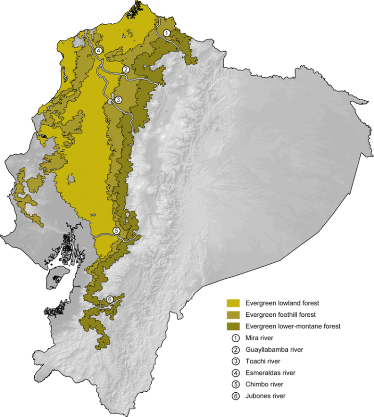
In fact, much of the forest still exists today. The Colombian and Panamanian patches remain relatively intact. However, in Ecuador, it’s a different story. Only 4% of the original Western Ecuador Moist Forests remains, making it one of the most threatened forests on earth.
The Western Ecuador moist forests ecoregion is part of a global Biodiversity Hotspot: the Chocó-Darién-Magdalena ecoregion. This lush jungle challenges the Upper Amazon for the title of most biodiverse site on the planet. Don’t forget your umbrella though: these forests experience some of the world’s wettest conditions. Annual rainfall can be up to 8,000 mm in the north.
The moist forest stretches through the provinces of Esmeraldas, Manabí, and Guayas, reaching the Gulf of Guayaquil in the south and the foothills of the Andes in the east. The ecoregion is between 100 and 200 kilometers wide and covers an area of 34,108 square kilometers.
Another name for the Western Ecuador moist forest is the Chocó rainforest, or just Chocó. Originally the name Chocó comes from a state in Colombia, but nowadays it’s used for the whole ecoregion stretching from southwest Panama to northwest Ecuador.
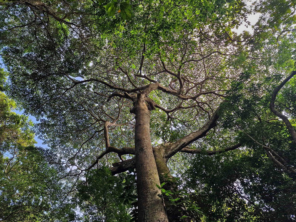
The moist forest is visibly different from the cloud forest. The vegetation stays green all year like a rainforest, but it has more color variety, and the plant species are different. The trees here are taller than in the cloud forest. The canopy is made up of large native hardwood trees, often with huge, strong roots at their base.
This ecoregion includes the coastal plain and extends to the lower slopes of the Andes, reaching up to about 800 meters (2,600 feet) above sea level. The forest is moist here because it gets a lot of rain and has no real dry season. Rainfall is heavier in the north. Some places near the Colombia-Ecuador border get over 8,000 mm of rain yearly, making it one of the wettest places on the planet! Further south, the moist forests get drier and eventually transition into deciduous dry forest.
In the past, volcanic activity shaped this ecoregion, creating fertile soils, especially in the north. The moist forests are full of tall trees with a canopy over 30 meters high, with impressive ceibas and tropical hardwoods. These trees form a thick canopy that blocks much of the sunlight, keeping the environment cool and humid. There are many climbing plants (lianas) and plants that grow on trees (epiphytes).
Despite all the deforestation, the Western Ecuador moist forests are still a haven for biodiversity. About 10,000 plant species have been recorded in the area, and a quarter of those are unique to this region. The natural fragmentation within the forests has led to the fast development of new endemic species in specific niches, such as mountain ridges or small strips of land.
Even in small patches of the moist forest, the biodiversity can be mind-blowing. In one area, scientists found 1,250 plant species in just 1 square kilometer, from 136 families, including 43 species that are found nowhere else.1 The largest trees can grow over 60 meters tall. The lower parts of tree trunks are often covered by epiphytes such as Araceae and Cyclanthaceae, while ferns make up the thick understory.
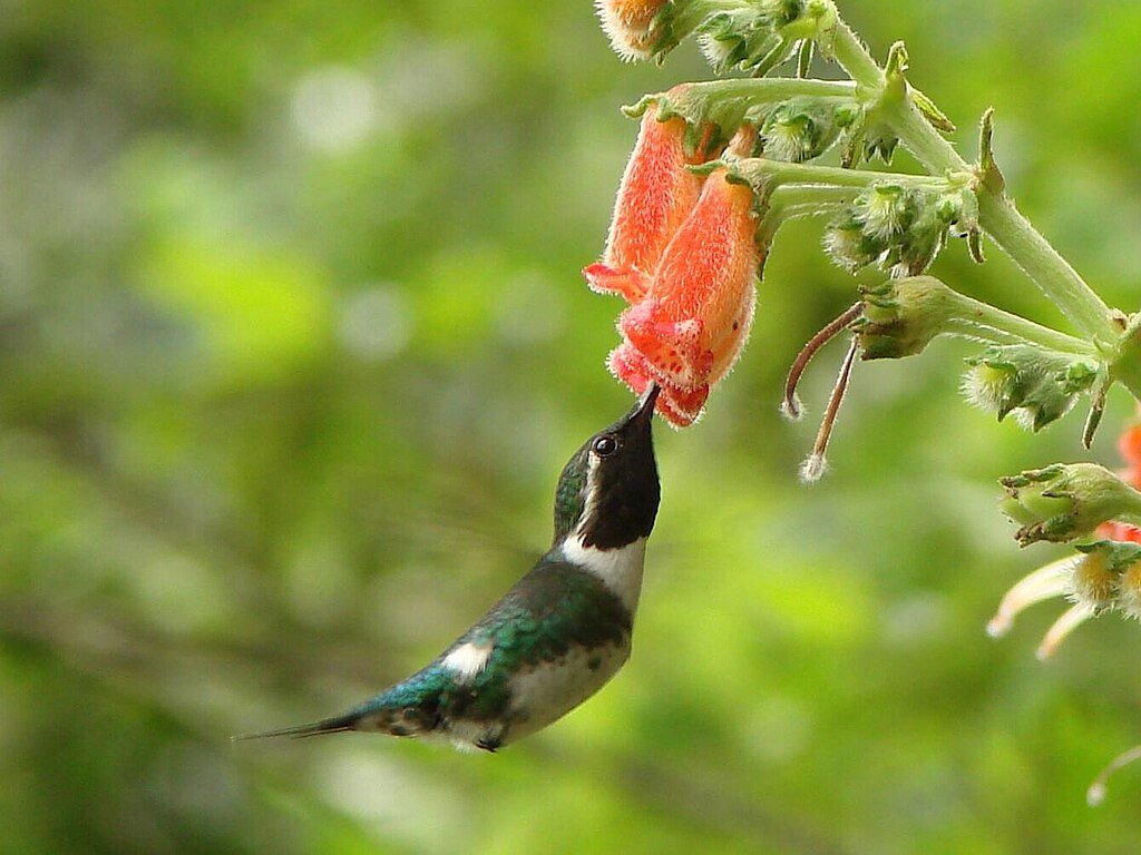
For birds, the region is no less biodiverse. 650 species have been counted here. The Chocó is also known for its high percentage of endemic birds species. Unfortunately, many are now threatened due to habitat fragmentation and sometimes hunting. Species like the harpy eagle, great curassow, and the great green macaw have become almost extinct in the region.
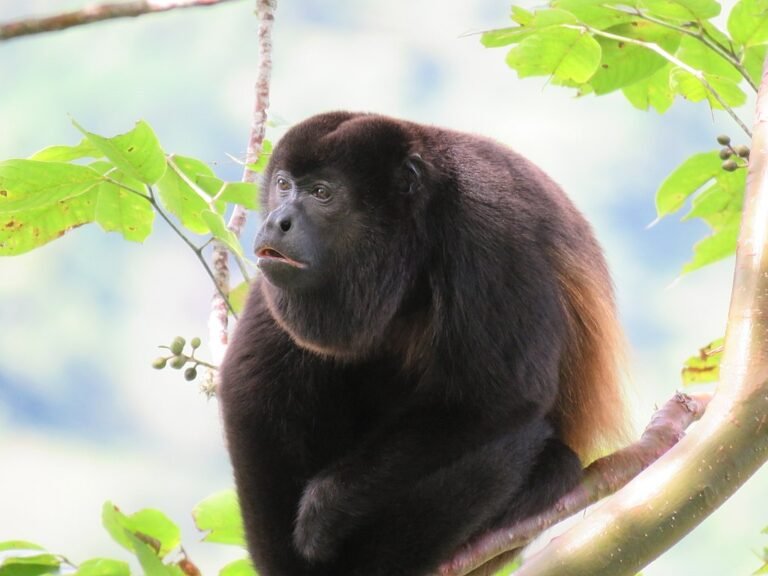
Within the realm of mammals, the howler monkey is a conspicuous resident. With calls that can be heard 5 kilometers away in dense forest, they are the loudest land mammal on earth. The Ecuadorian Mantled Howler lives from Panama to Peru, and owes its name to the long hairs on their side, resembling a mantle. Unfortunately their calls are becoming increasingly rare. Their numbers are decreasing, and since 2008 the Ecuadorian Mantled Howler has been listed as Vulnerable by the IUCN Red List.2
The Chocó offers ideal conditions for new species to evolve.
Only 2% of the original Ecuadorian lowland forest cover has survived to this day. Where there used to be diverse forests, there are now banana plantations. Originally, the moist forests covered about 40% of western Ecuador. The remaining patches of forest are in great danger from illegal and legal logging, oil palm plantations, and mining activities.
This is why the Chocó is often mentioned as a top priority for conservation.3
Western Ecuador’s soils are very fertile, especially compared to those in the Amazon. This made the region highly attractive for farming. In addition, the annual dry season of at least four months allowed for easier access, further driving agricultural expansion.
At the current rate of deforestation, most remaining coastal forests could disappear in just 25 to 30 years.
The most intact forests are situated in the northwest in the province of Esmeraldas. In the center, small patches of moist forest remain, but are severely threatened by human encroachment.
The two main nature reserves in the area are Mache-Chindul and Cotacachi-Cayapas.
Mache-Chindul is under severe pressure from encroachment of the surrounding communities, whose numbers have steadily increased. Only 61% of the reserve remains in a natural state.4 The challenges include:

In the remote Cotacachi-Cayapas Ecological Reserve, the situation is a lot better. This huge area of 304,400 hectares has been protected since 1968. Its remote location also helped to keep the park largely intact – up to 99% of the park’s forests were in a good state in 2018. However, most of the reserve’s land lies above 500 meters, up to the peak of the Cotacachi vulcano at 4,944 meters. That means the most endangered habitat, the Chocó lowland forest below 300 meters, is not included.6
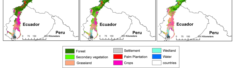
Looking at the areas that have been deforested in northwestern Ecuador, researchers found7 that the moist forests have been converted into:
So, what should we focus on to make the biggest Impact for Nature?
Our focus is the northwestern corner of Ecuador: the Esmeraldas province. Why? Here are our key considerations to maximize impact:
1. Dodson & Gentry 1987. Link to article.
2. IUCN Red List. Link to website.
3. Maquipuquna. Link to website.
4. Finer & Mamani, 2019. MAAP Program. Link to article.
5. Villacís et al., 2017. Ecociencia. Link to article.
6. Cardona, 2019. Mongabay. Link to article.
7. Fagua et al., 2019. Link to article.
Dream big, start small
Leave your email and
be the first to receive updates!